
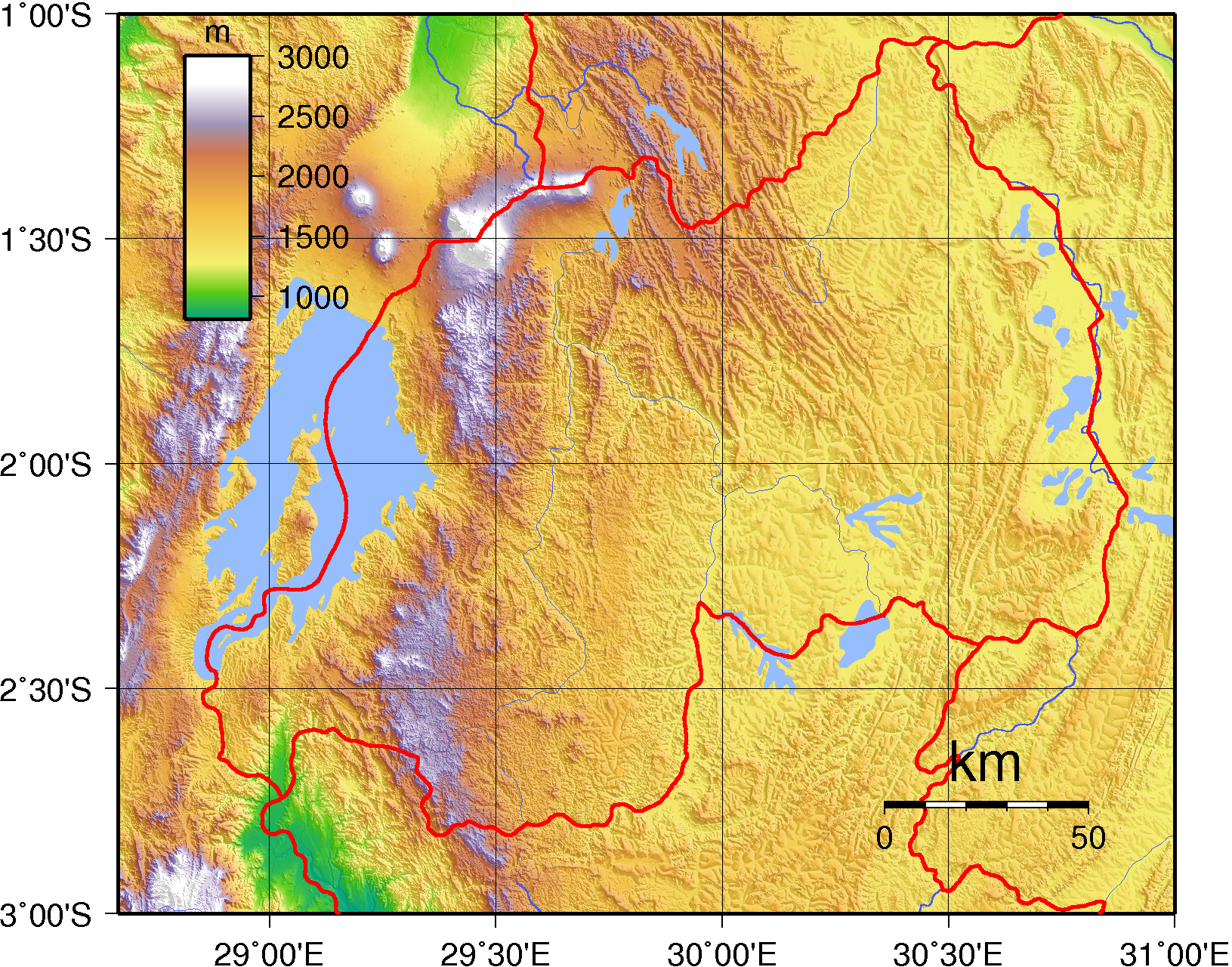
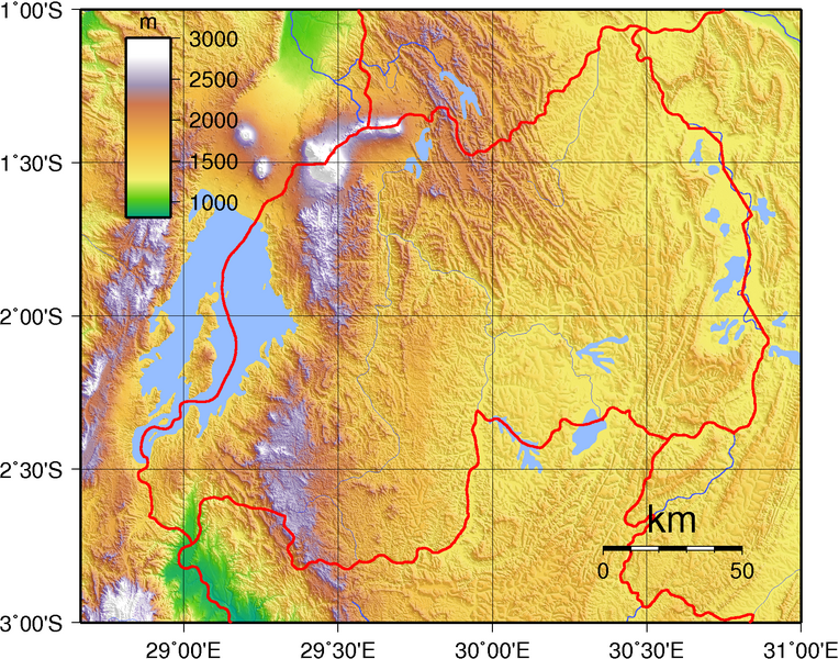
Dosiye:Rwanda Topography.png
Ingano yiri shusho:764 × 600 pixels. Indi ingano zagutse: 306 × 240 pixels | 612 × 480 pixels | 979 × 768 pixels | 1.280 × 1.005 pixels | 1.631 × 1.280 pixels.
Dosiye nyirizina (1.631 × 1.280 pixels, file size: 3,36 MB, MIME type: image/png)
Incamake
| Umwirondoro | Topographic map of Rwanda. Created with GMT from publicly released SRTM data. |
| Itariki | |
| Inkomoko | Own work |
| Umwanditsi | Sadalmelik |
Uruhushya
| This work has been released into the public domain by its author, I, Sadalmelik. This applies worldwide. In some countries this may not be legally possible; if so: I, Sadalmelik grants anyone the right to use this work for any purpose, without any conditions, unless such conditions are required by law. |
Amateka ya dosiye
Kanda kwitariki/n'isaha kugirango ufungure dosiye nkuko yagaragaye cyagihe.
| Itariki/Isaha | Ifoto ntoya | Ibipimo | Umukoresha | Comment | |
|---|---|---|---|---|---|
| muri iki gihe | 20:51, 29 Kamena 2007 | | 1.631 × 1.280 (3,36 MB) | Sadalmelik | Better colours |
| 12:28, 17 Kamena 2007 |  | 1.631 × 1.280 (3,34 MB) | Sadalmelik | {{Information |Description=Topographic map of Rwanda. Created with GMT from publicly released SRTM data. |Source=self-made |Date=June 17, 2007 |Author= Sadalmelik }} Category:Maps of Rwanda Category:Topographic maps of Rwanda |
Ikoreshwa rya dosiye
Ibi bikurikira 3 imikoreshereze yarwo iyi dosiye:
Ikoreshwa rya dosiye rusange
Izindi wiki zikurikira zikoresha iyi dosiye:
- Ikoreshwa kuri avk.wikipedia.org
- Ikoreshwa kuri be-tarask.wikipedia.org
- Ikoreshwa kuri bg.wikipedia.org
- Ikoreshwa kuri ca.wikipedia.org
- Ikoreshwa kuri da.wikipedia.org
- Ikoreshwa kuri de.wikipedia.org
- Ikoreshwa kuri en.wikipedia.org
- Ikoreshwa kuri es.wikipedia.org
- Ikoreshwa kuri et.wikipedia.org
- Ikoreshwa kuri fa.wikipedia.org
- Ikoreshwa kuri he.wikipedia.org
- Ikoreshwa kuri hu.wikipedia.org
- Ikoreshwa kuri hy.wikipedia.org
- Ikoreshwa kuri ig.wikipedia.org
- Ikoreshwa kuri it.wikipedia.org
- Ikoreshwa kuri ja.wikipedia.org
- Ikoreshwa kuri ka.wikipedia.org
- Ikoreshwa kuri mdf.wikipedia.org
- Ikoreshwa kuri mt.wikipedia.org
- Ikoreshwa kuri ru.wikipedia.org
- Ikoreshwa kuri sr.wikipedia.org
- Ikoreshwa kuri tum.wikipedia.org
- Ikoreshwa kuri uk.wikipedia.org
- Ikoreshwa kuri vec.wikipedia.org
- Ikoreshwa kuri vep.wikipedia.org
- Ikoreshwa kuri xmf.wikipedia.org
- Ikoreshwa kuri zh.wikipedia.org