
Dosiye:Congo Map by Stanley.jpg
Ingano yiri shusho:800 × 450 pixels. Indi ingano zagutse: 320 × 180 pixels | 640 × 360 pixels | 1.024 × 576 pixels | 1.280 × 720 pixels | 2.560 × 1.440 pixels | 5.312 × 2.988 pixels.
Dosiye nyirizina (5.312 × 2.988 pixels, file size: 4,32 MB, MIME type: image/jpeg)
Incamake
| Umwirondoro |
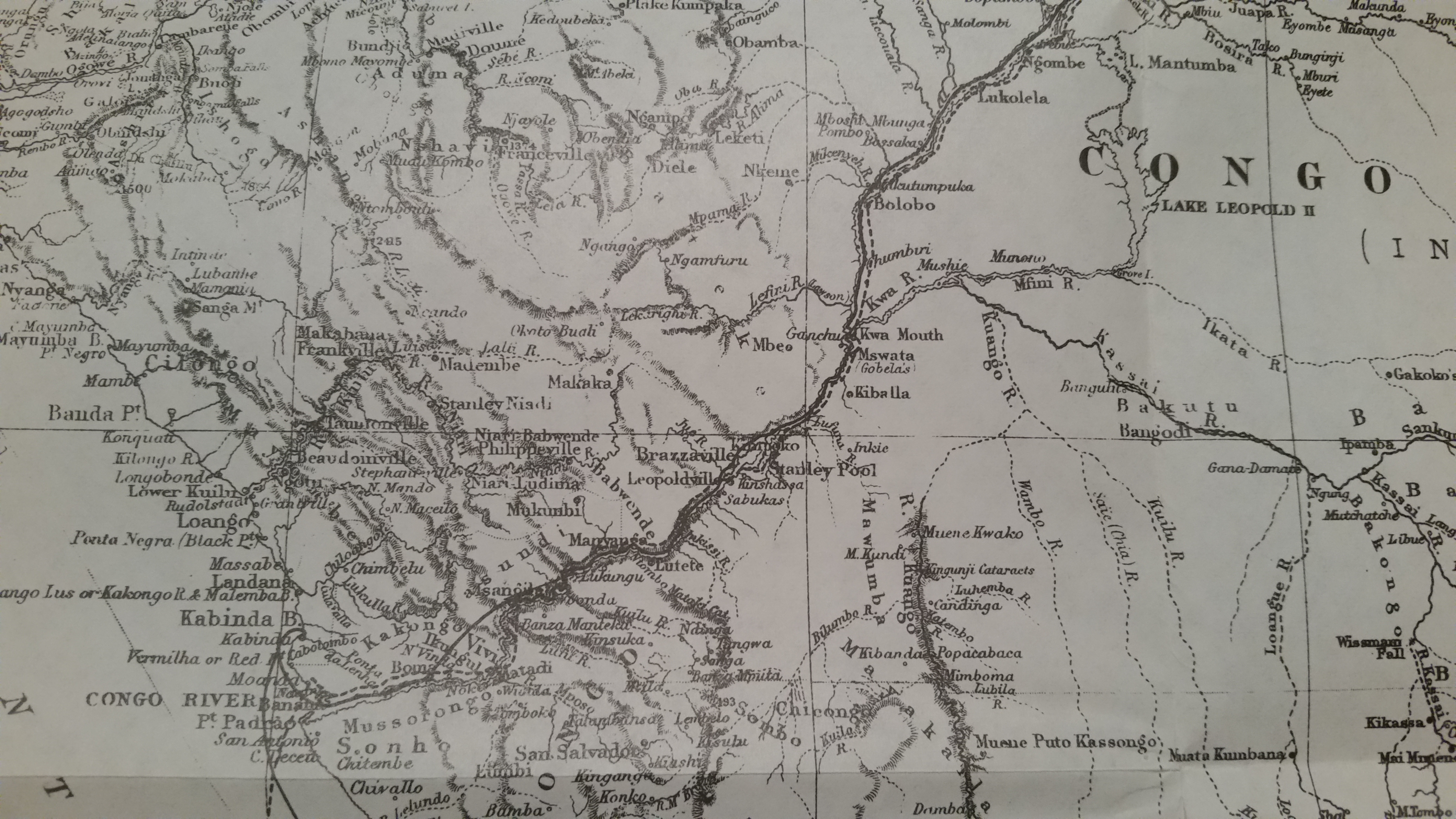
English: Congo Map by Stanley |
| Itariki | |
| Inkomoko | Through the Dark Continent |
| Umwanditsi | Henry M. Stanley |
Uruhushya
|
This work is in the public domain in its country of origin and other countries and areas where the copyright term is the author's life plus 70 years or fewer. This work is in the public domain in the United States because it was published (or registered with the U.S. Copyright Office) before January 1, 1929. | |
| This file has been identified as being free of known restrictions under copyright law, including all related and neighboring rights. | |
Amateka ya dosiye
Kanda kwitariki/n'isaha kugirango ufungure dosiye nkuko yagaragaye cyagihe.
| Itariki/Isaha | Ifoto ntoya | Ibipimo | Umukoresha | Comment | |
|---|---|---|---|---|---|
| muri iki gihe | 21:45, 30 werurwe 2015 | | 5.312 × 2.988 (4,32 MB) | Pi3.124 | User created page with UploadWizard |
Ikoreshwa rya dosiye
Ibi bikurikira abakoresha urupapuro iyi dosiye:
Ikoreshwa rya dosiye rusange
Izindi wiki zikurikira zikoresha iyi dosiye:
- Ikoreshwa kuri ca.wikipedia.org
- Ikoreshwa kuri en.wikipedia.org
- Ikoreshwa kuri es.wikipedia.org
- Ikoreshwa kuri fa.wikipedia.org
- Ikoreshwa kuri ha.wikipedia.org
- Ikoreshwa kuri he.wikipedia.org
- Ikoreshwa kuri id.wikipedia.org
- Ikoreshwa kuri ml.wikipedia.org
- Ikoreshwa kuri my.wikipedia.org
- Ikoreshwa kuri pt.wikipedia.org
- Ikoreshwa kuri tr.wikipedia.org
- Ikoreshwa kuri uk.wikipedia.org