
Dosiye:Un-rwanda.png

Dosiye nyirizina (3.038 × 2.258 pixels, file size: 1,43 MB, MIME type: image/png)
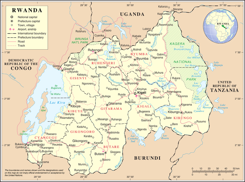
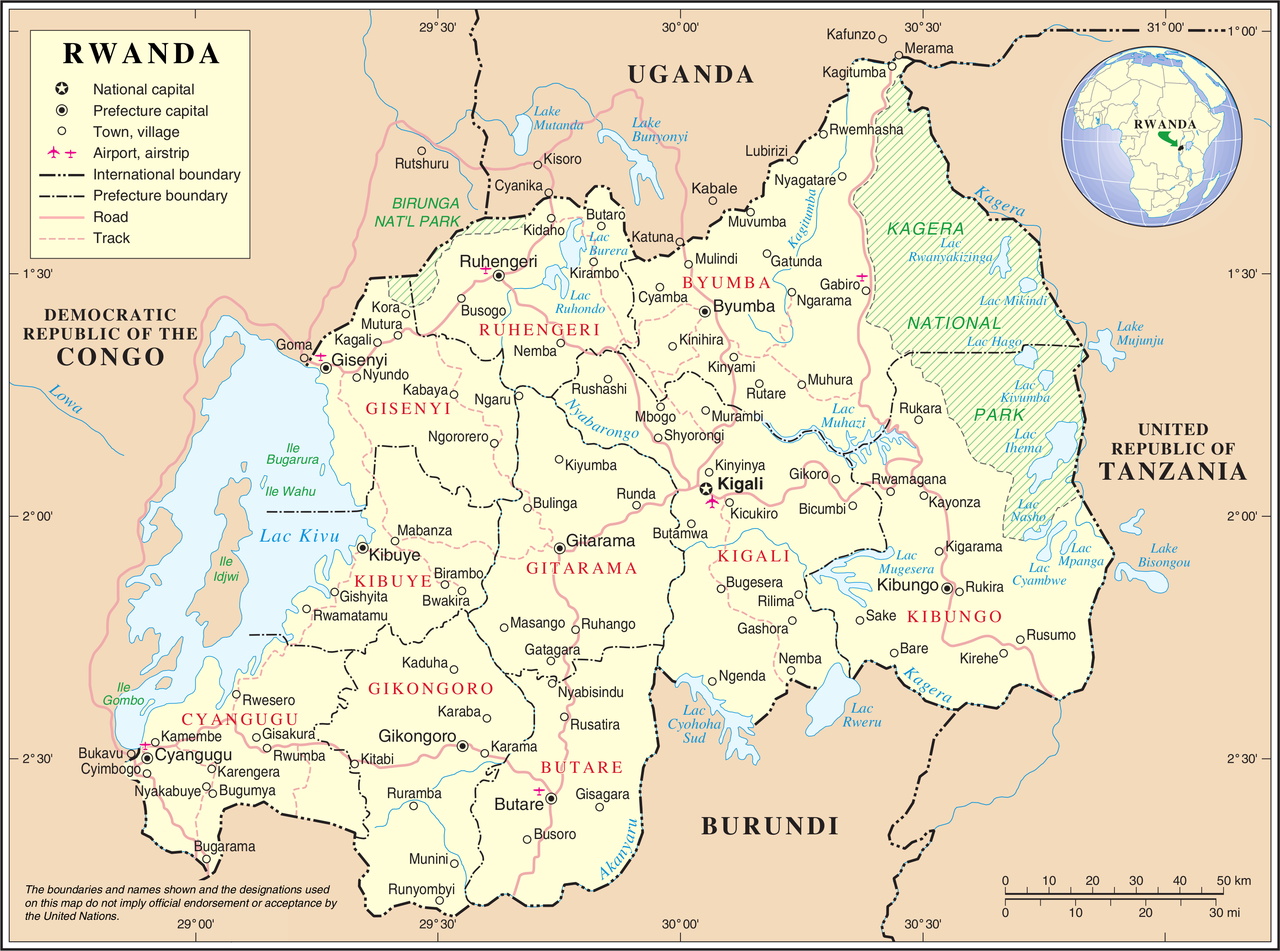
| Umwirondoro | United Nations Map showing Rwanda prior to the reform of its subdivision in 2006 | |||
| Inkomoko | ||||
| Umwanditsi | United Nations Cartographic Section | |||
| Permission (Reusing this file) |
|

Amateka ya dosiye
Kanda kwitariki/n'isaha kugirango ufungure dosiye nkuko yagaragaye cyagihe.
| Itariki/Isaha | Ifoto ntoya | Ibipimo | Umukoresha | Comment | |
|---|---|---|---|---|---|
| muri iki gihe | 02:11, 24 Ukwakira 2007 | | 3.038 × 2.258 (1,43 MB) | Jeroen | {{UN map}} Category:Maps of Rwanda |
Ikoreshwa rya dosiye
Ibi bikurikira abakoresha urupapuro iyi dosiye:
Ikoreshwa rya dosiye rusange
Izindi wiki zikurikira zikoresha iyi dosiye:
- Ikoreshwa kuri avk.wikipedia.org
- Ikoreshwa kuri ca.wikipedia.org
- Ikoreshwa kuri ckb.wikipedia.org
- Ikoreshwa kuri en.wikipedia.org
- Ikoreshwa kuri fa.wikipedia.org
- Ikoreshwa kuri fr.wikipedia.org
- Ikoreshwa kuri id.wikipedia.org
- Ikoreshwa kuri ja.wikipedia.org
- Ikoreshwa kuri mg.wikipedia.org
- Ikoreshwa kuri mzn.wikipedia.org
- Ikoreshwa kuri nl.wikipedia.org
- Ikoreshwa kuri no.wikipedia.org
- Ikoreshwa kuri pl.wiktionary.org
- Ikoreshwa kuri ru.wikipedia.org
- Ikoreshwa kuri uk.wikipedia.org
- Ikoreshwa kuri wa.wikipedia.org
- Ikoreshwa kuri www.wikidata.org