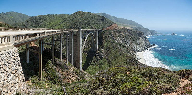
Dosiye:Bixby Creek Bridge, California, USA - May 2013.jpg
Appearance

Ingano yiri shusho:800 × 396 pixels. Indi ingano zagutse: 320 × 159 pixels | 640 × 317 pixels | 1.024 × 507 pixels | 1.280 × 634 pixels | 2.560 × 1.268 pixels | 6.488 × 3.214 pixels.
Dosiye nyirizina (6.488 × 3.214 pixels, file size: 7,84 MB, MIME type: image/jpeg)
Amateka ya dosiye
Kanda kwitariki/n'isaha kugirango ufungure dosiye nkuko yagaragaye cyagihe.
| Itariki/Isaha | Ifoto ntoya | Ibipimo | Umukoresha | Igitekerezo | |
|---|---|---|---|---|---|
| muri iki gihe | 09:38, 30 Kanama 2017 |  | 6.488 × 3.214 (7,84 MB) | Nikhil B | Reverted to version as of 06:34, 28 May 2013 (UTC) |
| 08:26, 18 Kamena 2017 |  | 1.920 × 951 (770 KB) | Dpalma01 | Color corrected file. | |
| 06:34, 28 Gicurasi 2013 |  | 6.488 × 3.214 (7,84 MB) | Diliff | {{Information |Description ={{en|1=Bixby Creek Bridge, viewed from the northern side near Big Sur on the Central Californian Coast in the United States.}} |Source ={{own}} |Author =Diliff |Date =2013-05-20 |... |
Ikoreshwa rya dosiye
Ibi bikurikira 2 imikoreshereze yarwo iyi dosiye:
Ikoreshwa rya dosiye rusange
Izindi wiki zikurikira zikoresha iyi dosiye:
- Ikoreshwa kuri de.wikivoyage.org
- Ikoreshwa kuri en.wikipedia.org
- California State Route 1
- Wikipedia:WikiProject U.S. Roads/California
- Bixby Bridge
- User:Diliff
- Wikipedia:Featured pictures/Places/Architecture
- Talk:Bixby Bridge
- Portal:Architecture/Travel images
- List of state highways in California
- Wikipedia:WikiProject U.S. Roads/Recognized content
- Wikipedia:WikiProject U.S. Roads/California/Recognized content
- Wikipedia:WikiProject U.S. Roads/Main page content
- Wikipedia:Featured pictures thumbs/39
- User:EuroCarGT/Possible FPC
- Wikipedia:Featured picture candidates/Bixby Creek Bridge
- Wikipedia:Featured picture candidates/February-2014
- User talk:EuroCarGT/Archives/2014/February
- User talk:Diliff/Archive12
- Wikipedia:Picture of the day/December 2015
- Template:POTD/2015-12-26
- User talk:EuroCarGT/Archives/2015/December
- Wikipedia:Main Page history/2015 December 26
- User talk:Diliff/Archive14
- User:Tv's emory/Sandbox/List of state highways in California
- Wikipedia:WikiProject U.S. Roads/State highways
- Wikipedia:WikiProject U.S. Roads/State highways/Recognized content
- Big Sur Coast Highway
- Portal:The arts/Recognized content
- Portal:Architecture/Recognized content
- Ikoreshwa kuri fa.wikipedia.org
- ویکیپدیا:نگارههای برگزیده/جاها/معماری
- کاربر:Behnam mancini/نگارههای برگزیده نامزد شده
- ویکیپدیا:گزیدن نگاره برگزیده/مقالههای ناموجود/پیشنهادی
- ویکیپدیا:نگاره روز/مارس ۲۰۲۴
- ویکیپدیا:گزیدن نگاره برگزیده/اوت-۲۰۲۳
- بحث کاربر:Behnam mancini/بایگانی ۳
- ویکیپدیا:گزیدن نگاره برگزیده/Bixby Creek Bridge, California, USA - May 2013.jpg
- پل بیکسبی
- الگو:نر/2024-03-30
- الگو:نر محافظت شده/2024-03-30
- Ikoreshwa kuri fr.wikipedia.org
- Ikoreshwa kuri ha.wikipedia.org
- Ikoreshwa kuri he.wikipedia.org
- Ikoreshwa kuri he.wikivoyage.org
- Ikoreshwa kuri it.wikipedia.org
- Ikoreshwa kuri ka.wikipedia.org
- Ikoreshwa kuri ko.wikipedia.org
- Ikoreshwa kuri mg.wikipedia.org
View more global usage of this file.


