
Dosiye:Peleliu map.jpg

Ingano yiri shusho:366 × 599 pixels. Indi ingano zagutse: 146 × 240 pixels | 293 × 480 pixels | 850 × 1.392 pixels.
Dosiye nyirizina (850 × 1.392 pixels, file size: 505 KB, MIME type: image/jpeg)
Incamake
| Umwirondoro |
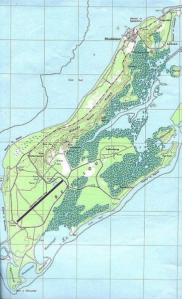
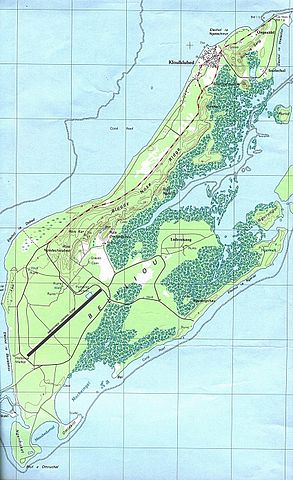
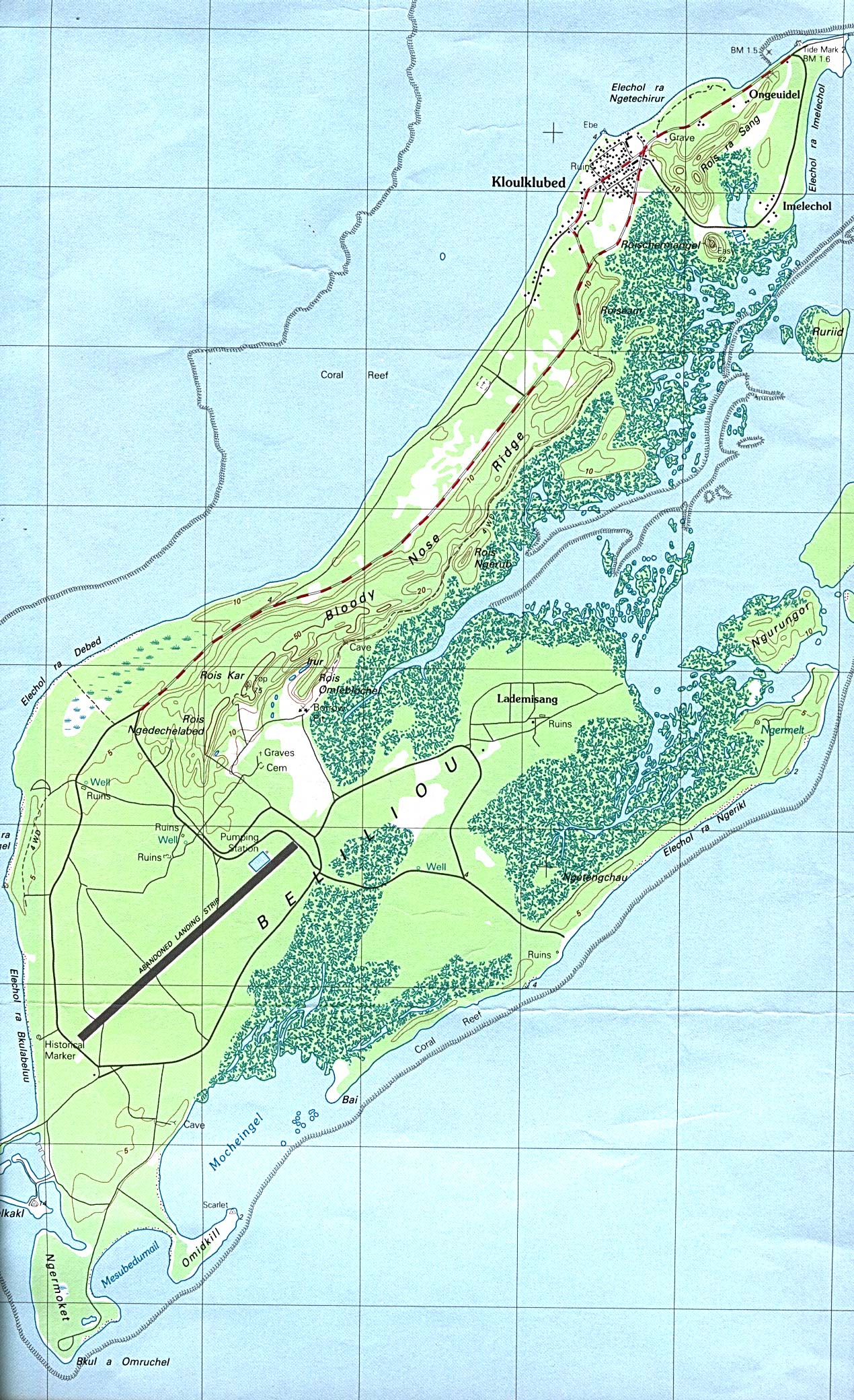
English: Map of Peleliu Island, Palau |
| Itariki | |
| Inkomoko | Perry-Castañeda Library Map Collection |
| Umwanditsi | USGS |
Uruhushya
This image is in the public domain in the United States because it only contains materials that originally came from the United States Geological Survey, an agency of the United States Department of the Interior. For more information, see the official USGS copyright policy.
|
Original upload log
All following user names refer to en.wikipedia.
- 2005-03-07 21:37 Darwinek 850×1392×8 (517270 bytes)
Amateka ya dosiye
Kanda kwitariki/n'isaha kugirango ufungure dosiye nkuko yagaragaye cyagihe.
| Itariki/Isaha | Ifoto ntoya | Ibipimo | Umukoresha | Comment | |
|---|---|---|---|---|---|
| muri iki gihe | 09:30, 26 Gashyantare 2008 | | 850 × 1.392 (505 KB) | File Upload Bot (Magnus Manske) | {{BotMoveToCommons|en.wikipedia}} {{Information |Description={{en|Map of Peleliu Island from Perry-Castañeda Library Map Collection [http://www.lib.utexas.edu/maps/islands_oceans_poles/palau_beliliou.jpg source]}} |Source=Transferred from [http://en.w |
Ikoreshwa rya dosiye
Ibi bikurikira abakoresha urupapuro iyi dosiye:
Ikoreshwa rya dosiye rusange
Izindi wiki zikurikira zikoresha iyi dosiye:
- Ikoreshwa kuri ar.wikipedia.org
- Ikoreshwa kuri bcl.wikipedia.org
- Ikoreshwa kuri ceb.wikipedia.org
- Ikoreshwa kuri de.wikipedia.org
- Ikoreshwa kuri de.wikivoyage.org
- Ikoreshwa kuri el.wikipedia.org
- Ikoreshwa kuri en.wikipedia.org
- Ikoreshwa kuri fi.wikipedia.org
- Ikoreshwa kuri it.wikipedia.org
- Ikoreshwa kuri ja.wikipedia.org
- Ikoreshwa kuri ka.wikipedia.org
- Ikoreshwa kuri ko.wikipedia.org
- Ikoreshwa kuri nl.wikipedia.org
- Ikoreshwa kuri pl.wikipedia.org
- Ikoreshwa kuri pt.wikipedia.org
- Ikoreshwa kuri sl.wikipedia.org
- Ikoreshwa kuri uk.wikipedia.org
- Ikoreshwa kuri vi.wikipedia.org
- Ikoreshwa kuri www.wikidata.org
- Ikoreshwa kuri zh.wikipedia.org