
Dosiye:Map of USVI.png

Ingano yiri shusho:800 × 571 pixels. Indi ingano zagutse: 320 × 229 pixels | 640 × 457 pixels | 1.024 × 731 pixels | 1.280 × 914 pixels | 2.100 × 1.500 pixels.
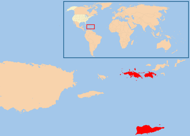
Dosiye nyirizina (2.100 × 1.500 pixels, file size: 49 KB, MIME type: image/png)
Incamake
| Umwirondoro | |
| Itariki | |
| Inkomoko | Own work |
| Umwanditsi | [User:te wiki] |
| Permission (Reusing this file) |
free commons (do whatever you want with this map) |
Uruhushya
| I, the copyright holder of this work, release this work into the public domain. This applies worldwide. In some countries this may not be legally possible; if so: I grant anyone the right to use this work for any purpose, without any conditions, unless such conditions are required by law. |
Amateka ya dosiye
Kanda kwitariki/n'isaha kugirango ufungure dosiye nkuko yagaragaye cyagihe.
| Itariki/Isaha | Ifoto ntoya | Ibipimo | Umukoresha | Comment | |
|---|---|---|---|---|---|
| muri iki gihe | 08:29, 18 Gashyantare 2013 | | 2.100 × 1.500 (49 KB) | JohnnyMrNinja | remove unused alpha, indexed colors and increased compression |
| 21:59, 23 Mutarama 2008 |  | 2.100 × 1.500 (116 KB) | Te wiki~commonswiki | {{Information |Description= Map of USA highlight Virgin Islands |Source= selfmade |Date= January 23, 2008 |Author= [User:te wiki] |Permission= free commons (do whatever you want with this map) |other_versions= }} |
Ikoreshwa rya dosiye
Ibi bikurikira abakoresha urupapuro iyi dosiye:
Ikoreshwa rya dosiye rusange
Izindi wiki zikurikira zikoresha iyi dosiye:
- Ikoreshwa kuri arz.wikipedia.org
- Ikoreshwa kuri azb.wikipedia.org
- Ikoreshwa kuri be.wikipedia.org
- Ikoreshwa kuri de.wikipedia.org
- Vorwahlergebnisse der Präsidentschaftswahl in den Vereinigten Staaten 2008
- Vorwahlergebnisse der Präsidentschaftswahl in den Vereinigten Staaten 2016
- Vorwahlergebnisse der Präsidentschaftswahl in den Vereinigten Staaten 2020
- Vorwahlergebnisse der Präsidentschaftswahl in den Vereinigten Staaten 2024
- Benutzer:Sarkana/Vorwahlergebnisse 2024
- Ikoreshwa kuri en.wikipedia.org
- Ikoreshwa kuri es.wikipedia.org
- Ikoreshwa kuri fr.wikipedia.org
- Ikoreshwa kuri gcr.wikipedia.org
- Ikoreshwa kuri io.wikipedia.org
- Ikoreshwa kuri kk.wikipedia.org
- Ikoreshwa kuri ml.wikipedia.org
- Ikoreshwa kuri pcd.wikipedia.org
- Ikoreshwa kuri pt.wikipedia.org
- Ikoreshwa kuri ro.wikipedia.org
- Ikoreshwa kuri rue.wikipedia.org
- Ikoreshwa kuri ru.wikipedia.org
- Ikoreshwa kuri simple.wikipedia.org
- Ikoreshwa kuri su.wikipedia.org
- Ikoreshwa kuri sv.wikipedia.org
- Ikoreshwa kuri uk.wikipedia.org
- Ikoreshwa kuri uk.wikinews.org
- Ikoreshwa kuri ur.wikipedia.org