
Dosiye:LocationWallisAndFutuna.png
No higher resolution available.
LocationWallisAndFutuna.png (250 × 158 pixels, file size: 6 KB, MIME type: image/png)
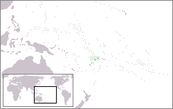
Location map for the Wallis and Futuna.
It was created by Oxhop.
| This work is ineligible for copyright and therefore in the public domain because it consists entirely of information that is common property and contains no original authorship. |
Amateka ya dosiye
Kanda kwitariki/n'isaha kugirango ufungure dosiye nkuko yagaragaye cyagihe.
| Itariki/Isaha | Ifoto ntoya | Ibipimo | Umukoresha | Comment | |
|---|---|---|---|---|---|
| muri iki gihe | 12:45, 17 werurwe 2005 | | 250 × 158 (6 KB) | Oxhop | Location map for the Wallis and Futuna.{{PD}} |
Ikoreshwa rya dosiye
Ibi bikurikira abakoresha urupapuro iyi dosiye:
Ikoreshwa rya dosiye rusange
Izindi wiki zikurikira zikoresha iyi dosiye:
- Ikoreshwa kuri af.wikipedia.org
- Ikoreshwa kuri ar.wikipedia.org
- Ikoreshwa kuri arz.wikipedia.org
- Ikoreshwa kuri ban.wikipedia.org
- Ikoreshwa kuri ba.wikipedia.org
- Ikoreshwa kuri be-tarask.wikipedia.org
- Ikoreshwa kuri be.wikipedia.org
- Ikoreshwa kuri bs.wikipedia.org
- Ikoreshwa kuri chr.wikipedia.org
- Ikoreshwa kuri de.wikipedia.org
- Ikoreshwa kuri de.wikivoyage.org
- Ikoreshwa kuri en.wikipedia.org
- Ikoreshwa kuri es.wikipedia.org
- Ikoreshwa kuri et.wikipedia.org
- Ikoreshwa kuri fa.wikipedia.org
- Ikoreshwa kuri frp.wikipedia.org
- Ikoreshwa kuri fr.wikipedia.org
- Ikoreshwa kuri hr.wikipedia.org
- Ikoreshwa kuri incubator.wikimedia.org
- Ikoreshwa kuri it.wikinews.org
- Ikoreshwa kuri it.wikivoyage.org
- Ikoreshwa kuri ja.wikipedia.org
- Ikoreshwa kuri ka.wikipedia.org
- Ikoreshwa kuri kk.wikipedia.org
- Ikoreshwa kuri ko.wikipedia.org
- Ikoreshwa kuri kw.wikipedia.org
- Ikoreshwa kuri lij.wikipedia.org
- Ikoreshwa kuri li.wikipedia.org
- Ikoreshwa kuri mr.wikipedia.org
- Ikoreshwa kuri ms.wikipedia.org
- Ikoreshwa kuri my.wikipedia.org
- Ikoreshwa kuri nl.wikipedia.org
- Ikoreshwa kuri nn.wikipedia.org
- Ikoreshwa kuri oc.wikipedia.org
- Ikoreshwa kuri pl.wikipedia.org
- Ikoreshwa kuri pl.wikivoyage.org
- Ikoreshwa kuri pl.wiktionary.org
- Ikoreshwa kuri pnb.wikipedia.org
- Ikoreshwa kuri pt.wikipedia.org
- Ikoreshwa kuri ro.wikipedia.org
- Ikoreshwa kuri ru.wikipedia.org
View more global usage of this file.