Dosiye:LakeKivu satellite.jpg
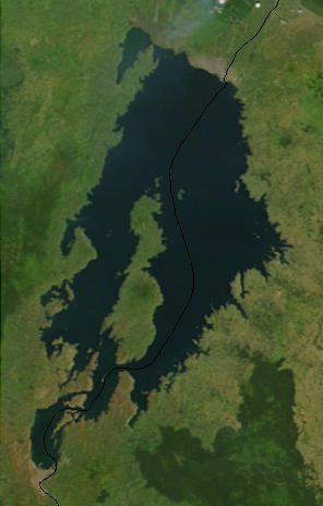
LakeKivu_satellite.jpg (296 × 464 pixels, file size: 21 KB, MIME type: image/jpeg)
Amateka ya dosiye
Kanda kwitariki/n'isaha kugirango ufungure dosiye nkuko yagaragaye cyagihe.
| Itariki/Isaha | Ifoto ntoya | Ibipimo | Umukoresha | Comment | |
|---|---|---|---|---|---|
| muri iki gihe | 14:19, 19 Nzeri 2010 |  | 296 × 464 (21 KB) | LobStoR | lossless crop from source NASA image at 250m resolution |
| 22:43, 24 Gicurasi 2006 |  | 295 × 476 (108 KB) | Dubhe | from en.wiki |
Ikoreshwa rya dosiye
There are no pages that use this file.
Ikoreshwa rya dosiye rusange
Izindi wiki zikurikira zikoresha iyi dosiye:
- Ikoreshwa kuri af.wikipedia.org
- Ikoreshwa kuri ar.wikipedia.org
- Ikoreshwa kuri arz.wikipedia.org
- Ikoreshwa kuri ast.wikipedia.org
- Ikoreshwa kuri bn.wikipedia.org
- Ikoreshwa kuri br.wikipedia.org
- Ikoreshwa kuri ca.wikipedia.org
- Ikoreshwa kuri ceb.wikipedia.org
- Ikoreshwa kuri cs.wikipedia.org
- Ikoreshwa kuri da.wikipedia.org
- Ikoreshwa kuri de.wikipedia.org
- Ikoreshwa kuri de.wikivoyage.org
- Ikoreshwa kuri dsb.wikipedia.org
- Ikoreshwa kuri el.wikipedia.org
- Ikoreshwa kuri en.wikipedia.org
- Ikoreshwa kuri eo.wikipedia.org
- Ikoreshwa kuri es.wikipedia.org
- Ikoreshwa kuri et.wikipedia.org
- Ikoreshwa kuri eu.wikipedia.org
- Ikoreshwa kuri fa.wikipedia.org
- Ikoreshwa kuri fi.wikipedia.org
- Ikoreshwa kuri fr.wikipedia.org
- Ikoreshwa kuri fr.wikivoyage.org
- Ikoreshwa kuri gl.wikipedia.org
- Ikoreshwa kuri he.wikipedia.org
- Ikoreshwa kuri hsb.wikipedia.org
- Ikoreshwa kuri hy.wikipedia.org
- Ikoreshwa kuri ig.wikipedia.org
- Ikoreshwa kuri it.wikipedia.org
- Ikoreshwa kuri ja.wikipedia.org
- Ikoreshwa kuri ka.wikipedia.org
- Ikoreshwa kuri ko.wikipedia.org
View more global usage of this file.


