
Dosiye:JAPAN EARTHQUAKE 20110311.png

Ingano yiri shusho:671 × 600 pixels. Indi ingano zagutse: 269 × 240 pixels | 537 × 480 pixels | 874 × 781 pixels.
Dosiye nyirizina (874 × 781 pixels, file size: 231 KB, MIME type: image/png)

|
File:JAPAN EARTHQUAKE 20110311.svg is a vector version of this file. It should be used in place of this PNG file when not inferior.
File:JAPAN EARTHQUAKE 20110311.png → File:JAPAN EARTHQUAKE 20110311.svg
For more information, see Help:SVG. |
 |
| This is a retouched picture, which means that it has been digitally altered from its original version. Modifications: EARTHQUAKE 20110311. The original can be viewed here: Japan location map with side map of the Ryukyu Islands.svg:
|
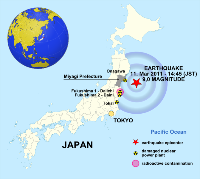
| Umwirondoro | EARTHQUAKE / 11.3.2011 - 14:45 (PT) / 9 MAGNITUDE |
| Itariki | (UTC) |
| Inkomoko | |
| Umwanditsi | |
| Other versions | • česká verze • german version • rumantsch version • español version |
.svg)
I, the copyright holder of this work, hereby publish it under the following licenses:
This file is licensed under the Creative Commons Attribution-Share Alike 3.0 Unported license.
- Ufite umudendezo:
- gusangiza – to copy, distribute and transmit the work
- to remix – gutangira ibikorwa
- Under the following conditions:
- umurimo – You must give appropriate credit, provide a link to the license, and indicate if changes were made. You may do so in any reasonable manner, but not in any way that suggests the licensor endorses you or your use.
- imigabane isa – If you remix, transform, or build upon the material, you must distribute your contributions under the same or compatible license as the original.

|
Permission is granted to copy, distribute and/or modify this document under the terms of the GNU Free Documentation License, Version 1.2 or any later version published by the Free Software Foundation; with no Invariant Sections, no Front-Cover Texts, and no Back-Cover Texts. A copy of the license is included in the section entitled GNU Free Documentation License. |
You may select the license of your choice.
Original upload log
This image is a derivative work of the following images:
- File:Japan_location_map_with_side_map_of_the_Ryukyu_Islands.svg licensed with Cc-by-sa-3.0, GFDL
- 2010-10-30T13:53:18Z NordNordWest 413x373 (948276 Bytes) Liancourts Rock boundary
- 2010-09-17T01:15:53Z Dinamik 413x373 (1638123 Bytes) medium color for disputed territories
- 2010-03-21T11:41:34Z Chumwa 413x373 (1597074 Bytes) Präfekturgrenzen bereinigt
- 2010-03-20T13:33:30Z Chumwa 413x373 (1793386 Bytes) Trennlinie zu Nebenkarte etwas verbreitert
- 2010-03-20T09:50:05Z Chumwa 413x373 (2010954 Bytes) == {{int:filedesc}} == {{Information |Description= {{de|Postionskarte von [[:de:Japan|Japan]]}} Quadratische Plattkarte. Bei Nutzung der Hauptkarte mit den Hauptinseln gelten folgende geographische Begrenzungen für die (Ges
Uploaded with derivativeFX
Amateka ya dosiye
Kanda kwitariki/n'isaha kugirango ufungure dosiye nkuko yagaragaye cyagihe.
| Itariki/Isaha | Ifoto ntoya | Ibipimo | Umukoresha | Comment | |
|---|---|---|---|---|---|
| muri iki gihe | 08:40, 31 werurwe 2011 | | 874 × 781 (231 KB) | W.Rebel | corr. time |
| 00:07, 31 werurwe 2011 |  | 874 × 781 (258 KB) | Obankston | corrected time and timezone; standardized date format | |
| 12:11, 19 werurwe 2011 |  | 874 × 781 (230 KB) | W.Rebel | update globe | |
| 11:11, 19 werurwe 2011 |  | 874 × 781 (182 KB) | Kintetsubuffalo | Reverted to version as of 05:31, 19 March 2011 remove border per WPMOS, again. I can keep up as long as you can | |
| 10:30, 19 werurwe 2011 |  | 874 × 781 (163 KB) | W.Rebel | update original | |
| 05:31, 19 werurwe 2011 |  | 874 × 781 (182 KB) | Sae1962 | Changed the magnitude of the earthquake from 8,9 to 9,0 on the Richter scale only. | |
| 12:28, 18 werurwe 2011 |  | 874 × 781 (163 KB) | Kintetsubuffalo | Reverted to version as of 15:02, 16 March 2011 per WPMOS on borders | |
| 19:26, 17 werurwe 2011 |  | 874 × 781 (164 KB) | W.Rebel | a common appearance as the other | |
| 15:02, 16 werurwe 2011 |  | 874 × 781 (163 KB) | Vearthy | removed border | |
| 15:23, 15 werurwe 2011 |  | 874 × 781 (160 KB) | Lordmetroid | Fixed spelling mistake |
Ikoreshwa rya dosiye
Ibi bikurikira abakoresha urupapuro iyi dosiye:
Ikoreshwa rya dosiye rusange
Izindi wiki zikurikira zikoresha iyi dosiye:
- Ikoreshwa kuri cs.wikipedia.org
- Ikoreshwa kuri da.wikipedia.org
- Ikoreshwa kuri de.wikipedia.org
- Ikoreshwa kuri el.wikipedia.org
- Ikoreshwa kuri en.wikipedia.org
- Ikoreshwa kuri es.wikipedia.org
- Ikoreshwa kuri et.wikipedia.org
- Ikoreshwa kuri fr.wikipedia.org
- Hokkaidō
- Sendai
- Préfecture de Chiba
- Préfecture de Fukushima
- Naoto Kan
- Préfecture d'Ibaraki
- Préfecture de Miyagi
- Préfecture d'Iwate
- Région du Tōhoku
- Région du Kantō
- Hakodate
- Higashimatsushima
- Kurihara
- Ishinomaki
- Kesennuma
- Ichihara
- Centrale nucléaire de Fukushima Daiichi
- Centrale nucléaire de Fukushima Daini
- Gouvernement Kan
- Kamaishi
- Séisme de 2011 de la côte Pacifique du Tōhoku
- Accident nucléaire de Fukushima
- Minamisanriku
- Rikuzentakata
- Yukio Edano
- Ōtsuchi
- Chronologie de l'accident nucléaire de Fukushima
- Opération Tomodachi
- Conséquences du séisme de 2011 de la côte Pacifique du Tōhoku sur l'industrie agroalimentaire
- Conséquences du séisme de 2011 de la côte Pacifique du Tōhoku sur l'industrie automobile
- Yoshihiro Murai
- Takuya Tasso
- Yūhei Satō
- Modèle:Palette Séisme de 2011 de la côte Pacifique du Tōhoku
- Conséquences du séisme de 2011 de la côte Pacifique du Tōhoku sur l'industrie du tourisme
- Conséquences de l'accident de Fukushima sur l'industrie nucléaire dans le monde
- Évolution de l'industrie nucléaire en France après l'accident de Fukushima
- Futaba (Fukushima)
- Conséquences de l'accident de Fukushima sur la centrale nucléaire de Fukushima Daiichi
View more global usage of this file.