
Dosiye:Location French Polynesia.png
No higher resolution available.
Location_French_Polynesia.png (250 × 158 pixels, file size: 9 KB, MIME type: image/png)
Incamake
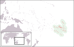
| Umwirondoro | Location of French-Polynesia |
| Itariki | 19 Gicurasi 2005 (original upload date) |
| Inkomoko | Own work |
| Umwanditsi | Mixcoatl at Ikinerilande Wikipediya |

|
This locator map image could be re-created using vector graphics as an SVG file. This has several advantages; see Commons:Media for cleanup for more information. If an SVG form of this image is available, please upload it and afterwards replace this template with
{{vector version available|new image name}}.
It is recommended to name the SVG file “Location French Polynesia.svg”—then the template Vector version available (or Vva) does not need the new image name parameter. |
Uruhushya
Mixcoatl at Ikinerilande Wikipediya, the copyright holder of this work, hereby publishes it under the following licenses:

|
Permission is granted to copy, distribute and/or modify this document under the terms of the GNU Free Documentation License, Version 1.2 or any later version published by the Free Software Foundation; with no Invariant Sections, no Front-Cover Texts, and no Back-Cover Texts. A copy of the license is included in the section entitled GNU Free Documentation License. |
| This file is licensed under the Creative Commons Attribution-Share Alike 3.0 Unported license. | ||
| Attribution: Mixcoatl at Ikinerilande Wikipediya | ||
| ||
| This licensing tag was added to this file as part of the GFDL licensing update. |
This file is licensed under the Creative Commons Attribution-Share Alike 2.5 Generic license.
Attribution: Mixcoatl at Ikinerilande Wikipediya
- Ufite umudendezo:
- gusangiza – to copy, distribute and transmit the work
- to remix – gutangira ibikorwa
- Under the following conditions:
- umurimo – You must give appropriate credit, provide a link to the license, and indicate if changes were made. You may do so in any reasonable manner, but not in any way that suggests the licensor endorses you or your use.
- imigabane isa – If you remix, transform, or build upon the material, you must distribute your contributions under the same or compatible license as the original.
You may select the license of your choice.
Original upload log
- 2005-05-19 12:39 Mixcoatl 250×158×8 (5822 bytes) [[Frans-Polynesië]], zelf gemaakt
Original upload log
| date/time | username | resolution | size | edit summary |
|---|---|---|---|---|
| 19:19, 28 March 2007 | User:SieBot | 250×158 | 6 KB | {{Information |Description=<a href="http://nl.wikipedia.org/wiki/Frans-Polynesi%C3%AB" class="extiw" title="nl:Frans-Polynesië">nl:Frans-Polynesië</a>, zelf gemaakt {{ewmulti||2007|01|24}} |Source=Originally from [http://nl.wikipedia.org nl.wikipedia]; description page is/was [http://nl.wikipedia.org/w/index.php?title=Image%3ALocatie_Frans_Polynesie. |
Amateka ya dosiye
Kanda kwitariki/n'isaha kugirango ufungure dosiye nkuko yagaragaye cyagihe.
| Itariki/Isaha | Ifoto ntoya | Ibipimo | Umukoresha | Comment | |
|---|---|---|---|---|---|
| muri iki gihe | 15:30, 16 Kamena 2017 | | 250 × 158 (9 KB) | Julieta39 | Real area of French Polynesian EEZ, since Antheaume (Benoît) and Bonnemaison (Joël) ''Atlas des îles et Etats du Pacifique Sud'', Publisud, Montpellier 1991, 126 p. (ISBN 978-2866004170). |
| 14:13, 19 Ugushyingo 2014 |  | 250 × 158 (7 KB) | Kontrollstellekundl | highlighted country and cropped | |
| 10:09, 2 Nyakanga 2009 |  | 250 × 158 (6 KB) | Telim tor | excluded soutrhern Cook Islands and Southern Line Islands | |
| 15:16, 8 Kanama 2008 |  | 250 × 158 (6 KB) | BetacommandBot | move approved by: User:Martin H. This image was moved from Image:Locatie Frans Polynesie.PNG {{Information |Description=nl:Frans-Polynesië, zelf gemaakt {{ewmulti||2007|01|24}} |Source=Originally from [http://nl.wikipedia.org nl.wikipedia |
Ikoreshwa rya dosiye
Ibi bikurikira abakoresha urupapuro iyi dosiye:
Ikoreshwa rya dosiye rusange
Izindi wiki zikurikira zikoresha iyi dosiye:
- Ikoreshwa kuri af.wikipedia.org
- Ikoreshwa kuri ang.wikipedia.org
- Ikoreshwa kuri ban.wikipedia.org
- Ikoreshwa kuri ba.wikipedia.org
- Ikoreshwa kuri be-tarask.wikipedia.org
- Ikoreshwa kuri be.wikipedia.org
- Ikoreshwa kuri bs.wikipedia.org
- Ikoreshwa kuri chr.wikipedia.org
- Ikoreshwa kuri de.wikipedia.org
- Ikoreshwa kuri el.wikipedia.org
- Ikoreshwa kuri en.wikipedia.org
- Ikoreshwa kuri en.wikivoyage.org
- Ikoreshwa kuri fa.wikipedia.org
- Ikoreshwa kuri fiu-vro.wikipedia.org
- Ikoreshwa kuri fr.wikipedia.org
- Ikoreshwa kuri gag.wikipedia.org
- Ikoreshwa kuri gl.wikipedia.org
- Ikoreshwa kuri he.wikivoyage.org
- Ikoreshwa kuri hi.wikipedia.org
- Ikoreshwa kuri id.wikipedia.org
- Ikoreshwa kuri incubator.wikimedia.org
- Ikoreshwa kuri it.wikipedia.org
- Polinesia francese
- Hao
- Ahe (atollo)
- Isole della Società
- Isole Marchesi
- Bora Bora
- Isole Sottovento (Polinesia Francese)
- Mehetia
- Moorea
- Template:Arcipelaghi della Polinesia francese
- Isole Gambier
- Isole Tuamotu
- Isole Australi
- Isole del Vento
- Raiatea
- Ahunui
- Akiaki
- Amanu
- Anaa
- Anuanuraro
- Anuanurunga
- Apataki
- Aratika
- Arutua
- Faaite
View more global usage of this file.