
Dosiye:LocationTuvalu.png
No higher resolution available.
LocationTuvalu.png (250 × 158 pixels, file size: 6 KB, MIME type: image/png)
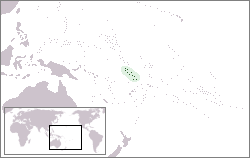
Location map for the Tuvalu.
Originally created for English Wikipedia by User:Vardion.
| |
This work has been released into the public domain by its author, Vardion, at the Icyongereza Wikipediya project. This applies worldwide. In case this is not legally possible: |
Amateka ya dosiye
Kanda kwitariki/n'isaha kugirango ufungure dosiye nkuko yagaragaye cyagihe.
| Itariki/Isaha | Ifoto ntoya | Ibipimo | Umukoresha | Comment | |
|---|---|---|---|---|---|
| muri iki gihe | 12:32, 14 Ukuboza 2004 | | 250 × 158 (6 KB) | Ahoerstemeier |
Ikoreshwa rya dosiye
Ibi bikurikira abakoresha urupapuro iyi dosiye:
Ikoreshwa rya dosiye rusange
Izindi wiki zikurikira zikoresha iyi dosiye:
- Ikoreshwa kuri ace.wikipedia.org
- Ikoreshwa kuri af.wikipedia.org
- Ikoreshwa kuri ar.wikipedia.org
- Ikoreshwa kuri ban.wikipedia.org
- Ikoreshwa kuri ba.wikipedia.org
- Ikoreshwa kuri be-tarask.wikipedia.org
- Ikoreshwa kuri bg.wikipedia.org
- Ikoreshwa kuri bn.wikipedia.org
- Ikoreshwa kuri bo.wikipedia.org
- Ikoreshwa kuri bpy.wikipedia.org
- Ikoreshwa kuri br.wikipedia.org
- Ikoreshwa kuri bs.wikipedia.org
- Ikoreshwa kuri ca.wikipedia.org
- Ikoreshwa kuri ceb.wikipedia.org
- Ikoreshwa kuri chr.wikipedia.org
- Ikoreshwa kuri ckb.wikipedia.org
- Ikoreshwa kuri de.wikinews.org
- Ikoreshwa kuri de.wikivoyage.org
- Ikoreshwa kuri de.wiktionary.org
- Ikoreshwa kuri en.wikipedia.org
- Ikoreshwa kuri en.wikibooks.org
- Ikoreshwa kuri en.wikinews.org
- Ikoreshwa kuri es.wikipedia.org
- Ikoreshwa kuri ext.wikipedia.org
- Ikoreshwa kuri fa.wikipedia.org
- Ikoreshwa kuri fiu-vro.wikipedia.org
- Ikoreshwa kuri fi.wikipedia.org
- Ikoreshwa kuri fo.wikipedia.org
- Ikoreshwa kuri fr.wikipedia.org
View more global usage of this file.